
12,400 acres between Hendersonville and Brevard, with four major waterfalls on the Little River and close to 90 miles of trail. The thing that trips up first-time visitors is that DuPont has six separate access areas, and the one you park at determines what you can reach on foot. This guide sorts that out first, then covers the waterfalls, the trails, and the practical details.
DuPont State Recreational Forest covers 12,400 acres across Henderson and Transylvania Counties in western North Carolina, between the towns of Hendersonville and Brevard. The forest is home to four major waterfalls along the Little River, several more on Grassy Creek, and close to 90 miles of multi-use trails open to hikers, mountain bikers, and horseback riders. Entry is free. The visitor center is at 89 Buck Forest Road in Cedar Mountain, at the intersection of Staton Road and Buck Forest Road.
The thing that trips up first-time visitors is that DuPont has six separate access areas spread around the forest, and the one you park at determines what you can reach on foot. Park at Guion Farm expecting High Falls and you have added an hour to your day before you start walking.
This guide sorts that out first, then covers the waterfalls, the trails, and the practical details you need to know as you plan your trip.
A Local's Guide to DuPont
The Essentials
The details you need before you head out to DuPont State Forest.
Visitor center hours, permit requirements, and trail closures all change through the year. Check the N.C. Forest Service's DuPont page before you drive out, and note that closures from Hurricane Helene remain in effect on parts of the trail network.
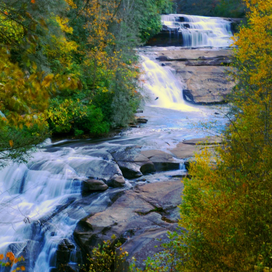
Choosing the wrong lot is a driving problem, not a walking one
DuPont has six access areas, spread far enough apart that the Lake Imaging lot sits two miles from High Falls and Guion Farm reaches none of the famous waterfalls. There is no single main entrance, and no lot from which everything is reachable on foot.
| Access Area | Address | What You Reach From Here |
|---|---|---|
| High Falls | 89 Buck Forest Road, Cedar Mountain | High Falls, Triple Falls, the covered bridge, the visitor center. The busiest area and the one most people want |
| Hooker Falls | Staton Road, Cedar Mountain | Hooker Falls and its swimming pool, plus trail access up toward Triple Falls |
| Lake Imaging | Lake Imaging Road, Hendersonville | Lake Imaging, Grassy Creek Falls, and the northern bike trail network. Two miles from High Falls |
| Corn Mill Shoals | Cascade Lake Road, Cedar Mountain | Cedar Rock granite slickrock, Big Rock, Corn Mill Shoals trail. Heavy mountain bike traffic |
| Guion Farm | Sky Valley Road area, Hendersonville | Open meadows, gentle family trails, and Wintergreen Falls. No access to the Little River waterfalls |
| Fawn Lake | 3051 Reasonover Road, Cedar Mountain | Fawn Lake, Lake Julia, and the Pinnacle Mountain area. The quiet end of the forest |
The High Falls and Hooker Falls rows are highlighted: those two areas sit on the Little River waterfall corridor.
Those two areas sit on the Little River waterfall corridor, and everything most visitors have seen photographs of is along it. The two lots are about a mile and a half apart by road.
This is the most useful thing to know about DuPont parking. When the High Falls lot is full, the Hooker Falls lot still gets you to Triple Falls on foot, and the reverse holds as well. A full lot changes your route rather than ending your plan.
It's a pleasant access area with meadows, easy walking, and Wintergreen Falls. It's also on the opposite side of the forest from High Falls, Triple Falls, and Hooker Falls, and you cannot reasonably walk to any of them from there. Visitors who arrive expecting the postcard waterfalls have to get back in the car.
At two miles from High Falls, it's too far to serve as a backup for a full waterfall lot. Park there when Grassy Creek Falls or the northern bike trails are what you came for.
Bridal Veil is 4.5 miles round trip from the High Falls area, which makes it a great hike rather than an add-on. Plan it as its own outing or as an extension of a longer day.
The N.C. Forest Service publishes two maps worth downloading before you go: a general forest map and a dedicated waterfall corridor map. Cell service inside the forest is limited, so download both rather than planning to look them up on arrival.
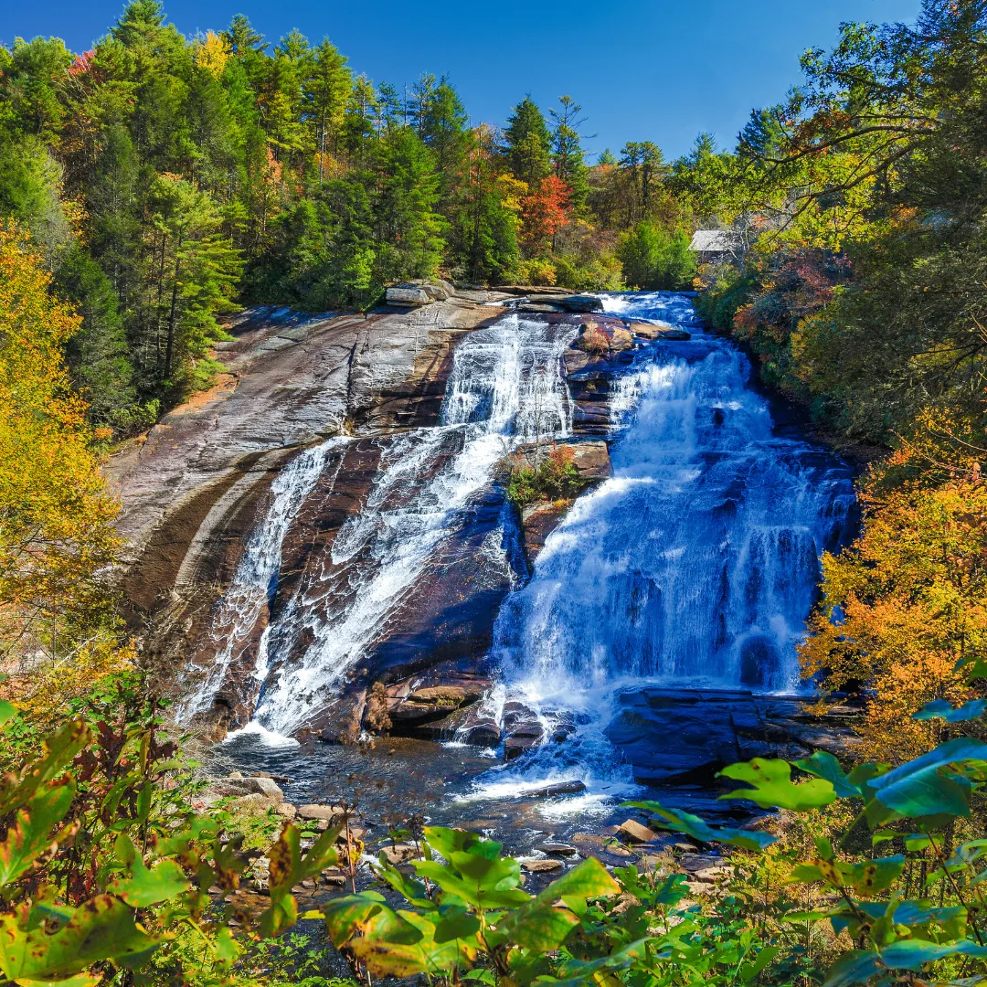
On the Little River
DuPont's four major waterfalls sit on the Little River, and three of them are close enough together to see in a single morning. Grassy Creek holds several more on the northern side of the forest, reached from a different access area.
A three-tiered cascade on the Little River that drops roughly 120 feet across its full run, with broad rock ledges separating each tier. It appeared in The Hunger Games, which has made it one of the most photographed waterfalls in North Carolina. Reachable from both the High Falls and Hooker Falls access areas, which makes it the most flexible stop in the forest when lots are full. A set of stairs leads down to the flat rock between the lower and middle tiers, which stays wet and grows algae, so water shoes with real tread are worth the trouble.
The tallest waterfall in DuPont, dropping more than 120 feet over a wide granite face on the Little River. Several overlooks along the trail give different vantage points, and the main overlook has a covered picnic shelter. The covered bridge above the falls is the other reason to come: it spans the Little River just upstream of the drop, built in the 1990s and now the most recognizable built feature in the forest. Both High Falls and the bridge are reached from the High Falls access area, where the visitor center is.
A wide, low waterfall on the Little River, around 12 feet tall, spilling into a broad pool. It's the one place in DuPont where swimming at the base is the point, and on summer weekends it functions as the forest's swimming hole. The trail is short, roughly 0.8 miles out and back on a graded gravel path. The walk in is downhill and the walk out is uphill, which surprises people on what looks like an easy stroll.
A wide, sloping waterfall that slides down a broad rock face rather than dropping vertically, which gives it a completely different character from the other three. Bridal Veil is 4.5 miles round trip from the High Falls area. The rock face below the falls is one of the more distinctive spots in the forest, and the approach along Conservation Road is easy walking on an old roadbed. Budget most of a morning if Bridal Veil is your destination.
Grassy Creek Falls and the other falls on the northern side of the forest are reached from the Lake Imaging access area, two miles from High Falls. They see a fraction of the traffic of the Little River corridor. Wintergreen Falls, on the same side of the forest, is 3.2 miles round trip from the Guion Farm access area.
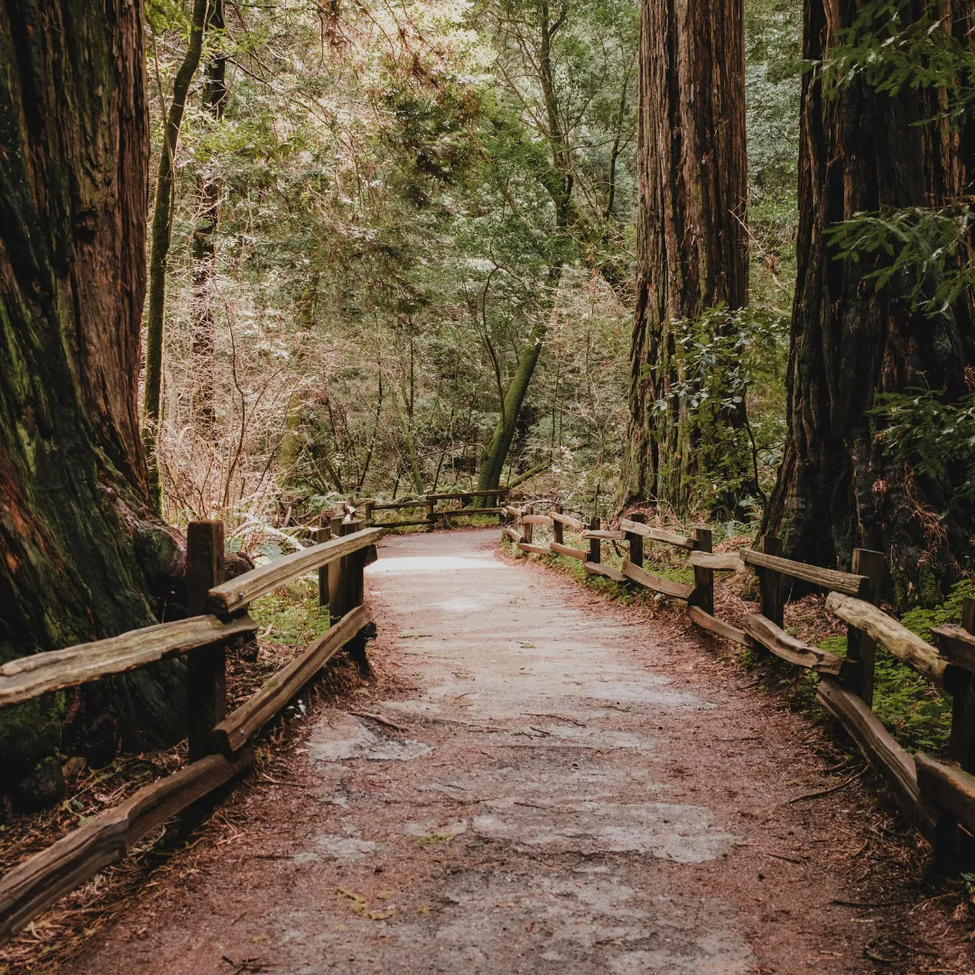
Old roadbeds and graded paths, not summit pushes
DuPont's trails are gentler than the ones across the county line in Pisgah. Most routes run on old roadbeds and graded paths rather than rooted, rocky climbs, which makes the forest a better fit for families, mixed-ability groups, and anyone who wants waterfalls without a summit push.
| Hike | Distance | Difficulty | Access Area | What You See |
|---|---|---|---|---|
| High Falls Loop | 3.2 mi loop | Easy to moderate | High Falls | Triple Falls, High Falls, the covered bridge |
| Hooker Falls Trail | 0.8 mi out & back | Easy | Hooker Falls | Hooker Falls and the swimming pool |
| Wintergreen Falls | 3.2 mi out & back | Easy to moderate | Guion Farm | Wintergreen Falls, meadows |
| Lake Julia Loop | 4.4 mi loop | Easy | Fawn Lake | Lake Julia, quiet forest, water views |
| Bridal Veil Falls | 4.5 mi out & back | Moderate | High Falls | Bridal Veil Falls, Conservation Road |
| Cedar Rock | 4 to 6 mi typical | Moderate | Corn Mill Shoals | Open granite slickrock, long views |
The 3.2-mile route takes in Triple Falls, High Falls, and the covered bridge in a single circuit, with roughly 400 feet of elevation change spread across the whole loop rather than concentrated in a climb. Most people walk it in an hour and a half at a relaxed pace, longer with stops at the overlooks. Picnic shelters sit along the route.
The trail climbs onto a broad expanse of exposed granite with open views across the forest, and the rock itself is the attraction. Grip is good on dry granite and poor on wet, so save it for a clear day. Route length depends on which trails you link together, starting from the Corn Mill Shoals access area.
The easy loop around Lake Julia runs 4.4 miles on flat to gently rolling ground, and the southern access areas see a fraction of the traffic of the waterfall corridor. The appeal here is water, quiet, and space rather than a single headline destination.
The route from Guion Farm runs 3.2 miles round trip through meadow and forest to a smaller falls, and the whole northern side of the forest stays calmer than the Little River corridor on a summer weekend.

Flow & Slickrock
DuPont is the smoother of the two great mountain biking forests near Brevard. Pisgah, across the county line, is famous for being technical, rooty, and punishing. DuPont rides faster and flows better, with more machine-built berms, more sustained descents, and far fewer sections that require a foot down. If you're an intermediate rider, or riding with a mixed-ability group, DuPont is the better choice. It also has something Pisgah doesn't: long stretches of exposed granite slickrock, the single most distinctive riding experience in western North Carolina.
The waterfall access areas are the wrong place to start. High Falls and Hooker Falls sit on the busiest walking corridor, and a summer weekend there means threading through families on foot. Corn Mill Shoals on Cascade Lake Road puts you straight into the slickrock and the Cedar Rock network. Lake Imaging opens onto the northern bike trails and reaches Ridgeline. Guion Farm works as a quieter northern start with gentler terrain.
The trail people drive to DuPont for. A purpose-built flow descent with banked turns and rollers, widely regarded as one of the best of its kind in the Southeast. It rewards a rider who wants speed rather than technical problem solving.
The slickrock routes, climbing onto broad expanses of open granite. Traction on dry granite is excellent and grip drops off sharply once it's wet, so these are clear-weather rides.
The flatter, faster network on the western side, and a reasonable warm-up before committing to the climbs.
Nearly every trail in DuPont is multi-use. You'll meet hikers and horses on most of what you ride, and blind corners on fast descents are where that becomes a problem. Bikes yield to both.
The Quiet End
DuPont's lakes are quieter than its waterfalls and easier to reach than its summits, which makes them the right destination on a busy weekend when the waterfall corridor is full.
The largest and most photographed of the four, ringed by forested shoreline with an easy 4.4-mile loop around it. The walking is flat to gently rolling, and the lake is reached from the Fawn Lake access area at the southern end. This is the part of DuPont that stays calm when the Little River corridor is at capacity.
A small reservoir with a boardwalk and a gazebo at the water's edge, which makes it one of the more pleasant places in the forest to sit rather than walk. Birdwatching is good here. The access area shares its name and is at 3051 Reasonover Road.
Sits deeper in the forest and sees less traffic than either of the above. It suits fishing and wildlife watching more than a destination hike.
The smallest of the four, a spring-fed pond easy to walk past without noticing. Worth the detour if you're already in the area and want somewhere quiet to stop.
Fishing is allowed in the lakes with a valid North Carolina fishing license.
All directions end at the High Falls access area
DuPont sits between Hendersonville and Brevard, and the visitor center is at 89 Buck Forest Road in Cedar Mountain, at the intersection of Staton Road and Buck Forest Road. The directions below all end at the High Falls access area, which is where the visitor center is and where most first-time visitors should start.
Take US-276 south to Cedar Mountain and turn left onto Cascade Lake Road. Continue 2.5 miles, then turn right onto Staton Road, also signed as DuPont Road. Continue 1.5 miles and the High Falls access area is on your right.
Take US-25 Business (Church Street) south to Kanuga Road. Turn right onto Kanuga Road, which becomes Crab Creek Road, and continue 11 miles. Turn left onto DuPont Road, also signed as Staton Road, and continue 3.1 miles.
Take I-26 east toward the Asheville airport and take exit 40. Head south on NC-280 for about 16 miles, then turn left onto US-64 east for about 4 miles. In Penrose, turn right onto Crab Creek Road and continue 4 miles to DuPont Road (also signed as Staton Road). Turn right and continue 3.1 miles to the High Falls access area on your left.
The Forest Service recommends entering the intersection of Crab Creek Road and DuPont Road rather than a street address. From that intersection, head south on DuPont Road for 4 miles to reach the High Falls access area on your left.
Cell service inside the forest is limited and unreliable near the trailheads. Download your route and your trail map before you leave the highway rather than planning to look them up when you arrive.
Before You Drive Out
A handful of things visitors are consistently unprepared for. None are complicated, but each one can shape how your day goes.
Cell Service Is Limited
Coverage drops off through most of the forest and is unreliable near the trailheads. Download your trail map and driving route before you leave the highway. This is the single most common thing visitors are unprepared for.
Wear Shoes With Real Tread
The rock around Triple Falls and Hooker Falls stays wet, grows algae, and is more slippery than it looks. Water shoes with a proper sole matter more here than boots do, since most of DuPont's walking is gentle.
Arrive Early on Summer Weekends
The waterfall access areas fill first and fill fastest. High Falls and Hooker Falls are the two most affected, and because they sit a mile and a half apart by road, a full lot means driving rather than walking to your backup.
Trails Are Multi-Use
Hikers, mountain bikers, and horses share nearly every route. Bikes yield to hikers and horses, hikers yield to horses, and when horses pass, step to the downhill side and stand still. Blind corners on faster descents are where this matters most.
Black Bears Live Here
DuPont sits in active black bear range. Bears generally avoid people, but don't leave food unattended at picnic areas, keep dogs leashed, and give any bear you see a wide berth rather than stopping to photograph it.
Pack Water and Food
There's no store, no concession, and no reliable place to buy anything inside the forest. The nearest supplies are in Brevard or Hendersonville, both around 25 to 30 minutes away.
Check Conditions First
Hours, permit requirements, and trail closures change through the year, and closures from Hurricane Helene remain in effect on parts of the trail network. Check the N.C. Forest Service closure and advisory pages the morning you go.
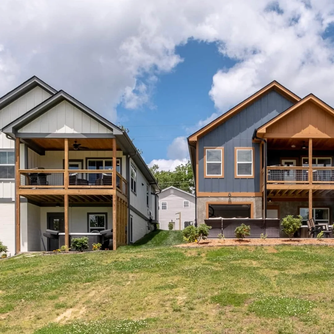
Depends on which town you'd rather spend your evenings in
Hendersonville is the closest, about 25 minutes. The larger of the two towns, with more hotels, a walkable Main Street, and the widest range of lodging near the forest. If DuPont is the main reason for your trip and you want the shortest drive to the trailhead, Hendersonville is the practical choice.
Brevard is about 30 minutes and gives you the rest of the region. Staying in Brevard puts you within reach of DuPont in one direction and the Pisgah waterfall corridor, Looking Glass Rock, and Sliding Rock in the other, which matters if you have more than one day. Brevard also has the better small-town evening, with an independent downtown and a compact restaurant scene.
Cedar Mountain is the small community immediately south of the forest, closer than either town but with far fewer options.
Valley Bear Farms sits on 200 private acres bordering Pisgah National Forest, about 50 minutes from the DuPont visitor center. Where we make more sense is a longer trip. We're 20 minutes from the Blue Ridge Parkway and Devil's Courthouse, and about 15 minutes from Cathedral Falls and French Broad Falls, so a stay here works best when DuPont is one day of several rather than the whole plan. The property has six miles of private trails, a spring-fed swimming pond, a wood-fired sauna, and an on-site store, and every accommodation has a kitchen or kitchenette.
If you want to be closer to DuPont, we have two houses in Brevard itself, about 30 minutes from the forest, and guests staying in them get full access to everything on the main property.
Book the Brevard Homes →Where to Stay
Seven accommodation types across the property, all sharing the same amenities: 6 miles of on-property trails, a natural spring-fed cold plunge pond, a wood-fired sauna, disc golf, pickleball, bocce ball, and a bathhouse with hot showers that feel incredible after a full day outside.
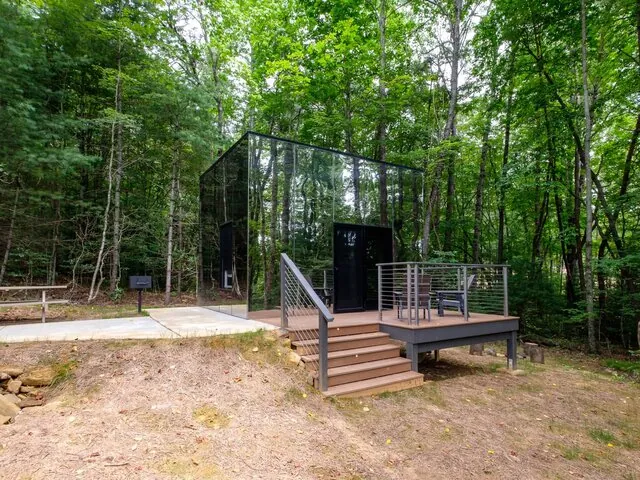
The most distinctive. Mirrored exterior walls reflect the surrounding forest so thoroughly that the cabin becomes nearly invisible. Inside: a king bed, wood finishes, a coffee station, mini fridge, and a private charcoal grill on the porch. Access to the shared bathhouse.
View & Book →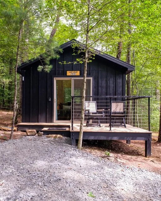
A single cabin set high in the forest canopy. King bed, firepit with firewood included, in-room coffee station, contactless check-in. Pet-friendly. Access to the shared bathhouse.
View & Book →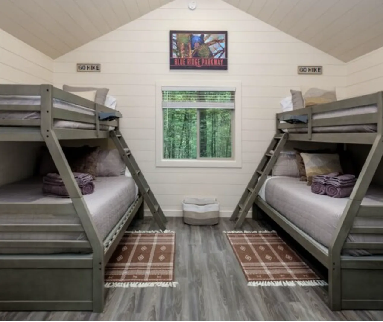
Two twin-over-full bunk beds, private firepit, charcoal grill. Pet-friendly. This cabin exists specifically because families need something that isn't a tiny room with two queen beds. The bunk setup works for kids and adults who don't mind close proximity.
View & Book →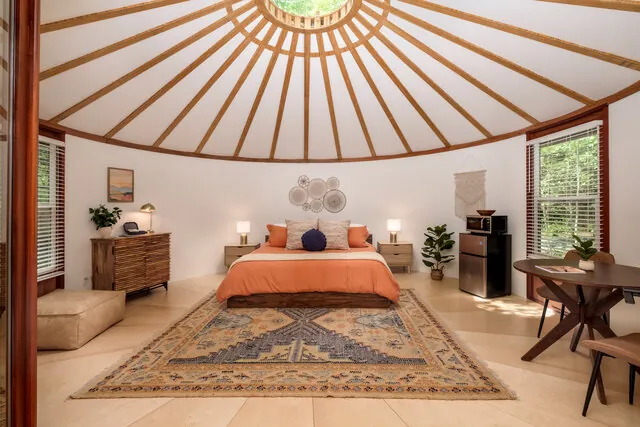
Hard-walled, fully insulated yurts positioned right beside a creek. You wake up to the sound of water. King bed, private deck, heating and air conditioning, coffee station, mini fridge, charcoal grill. Pet-friendly. A middle ground between glamping and actual seclusion.
View & Book →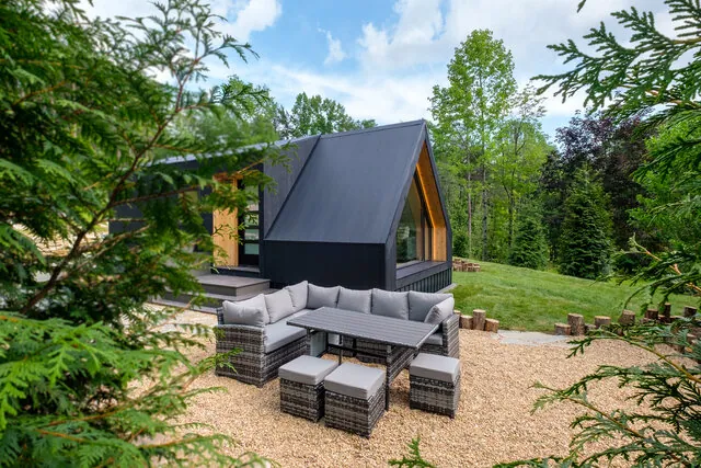
Modern A-frames with high ceilings, large windows, a kitchenette with a two-burner electric cooktop, and a private bathroom with a soaking tub. A king bed and king pull-out sofa sleep up to four. Dog-friendly.
View & Book →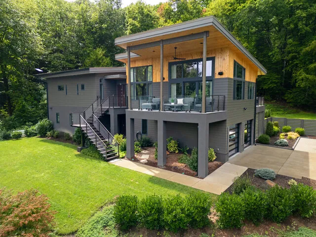
A three-bedroom modern lodge high on the property with panoramic views of the Pisgah wilderness. Chef's kitchen, private hot tub, indoor and outdoor gas fireplaces, three decks, EV charger, one king and two queen bedrooms, two full baths plus a powder room. The group property, sleeps up to 6. Not pet-friendly.
View & Book →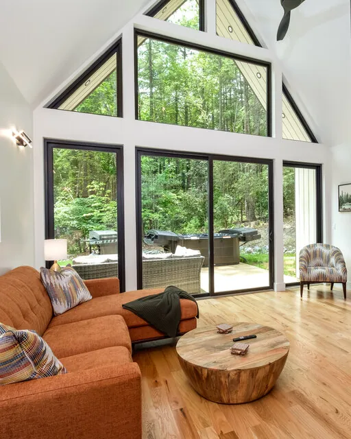
A three-bedroom home tucked into a quieter section of the property, built for families, friends, or couples who want more space without sacrificing privacy. The primary suite has a king bed and private bath, the second bedroom has a bunk setup for kids, and the third is a lofted room with its own lounge area. A glass wall in the main living area opens onto a private back porch with a gas grill, patio, and hot tub. Pet-friendly.
View & Book →Base at Valley Bear Farms and pair DuPont with Pisgah, the Parkway, and Brevard. Book direct for the best rate.
DuPont State Recreational Forest is free to enter, with no admission fee and no parking fee at any of the six access areas. Some activities require a permit from the N.C. Forest Service, and permit requirements change, so check the forest's official pages if you're planning anything beyond hiking, biking, or riding.
Park at the High Falls or Hooker Falls access areas to reach DuPont's three most-visited waterfalls. High Falls reaches High Falls, Triple Falls, and the covered bridge. Hooker Falls reaches Hooker Falls and its swimming pool, with trail access toward Triple Falls. The two lots are about a mile and a half apart by road. Guion Farm, Lake Imaging, Corn Mill Shoals, and Fawn Lake reach different parts of the forest and do not connect on foot to the Little River waterfalls.
Allow three to four hours to see Triple Falls, High Falls, and Hooker Falls at a relaxed pace. The High Falls Loop covers Triple Falls, High Falls, and the covered bridge in 3.2 miles and takes most people about an hour and a half. Hooker Falls is a separate 0.8-mile round trip from its own access area, reached by a short drive.
Dogs are allowed throughout DuPont State Recreational Forest on a leash. Trails are multi-use and shared with mountain bikers and horses, so keeping dogs leashed matters more here than in forests with hiker-only trails.
The DuPont visitor center is about 30 minutes from Brevard. Take US-276 south to Cedar Mountain, turn left onto Cascade Lake Road for 2.5 miles, then right onto Staton Road, also signed as DuPont Road, for 1.5 miles to the High Falls access area. Hendersonville is closer at about 25 minutes, and Asheville is about 60 minutes.
Yes. Wading and swimming are allowed at your own risk in most of the forest's water, with Hooker Falls the most popular swimming hole. Swimming is prohibited within 300 feet upstream of the top of any waterfall and in areas posted as non-swimming. There are no lifeguards, so use caution, especially near moving water and slick rock.
Book Direct · Best Rate Guaranteed
Pick the right access area, arrive before the lots fill, and DuPont delivers four waterfalls and the covered bridge in a single morning. It rewards a base you can settle into and pair with the rest of the region. Valley Bear Farms sits on 200 private acres bordering Pisgah, with trails, a spring-fed pond, and a wood-fired sauna waiting when you come back from a day out, or book one of our two houses in Brevard for the shortest drive to the forest.
For the wider area, see our guide to Brevard and the best hikes in Pisgah. When you're ready, pick your dates.
Book Your Stay at Valley Bear Farms